
Brazos River Update
The Brazos River has crested and dropped from flood stage, and river level projections remain below 40’. Now that this most recent threat has subsided, let’s recap the past few weeks:
River’s Edge is estimated to be at risk of flooding when Brazos River elevations reach 50.6’ on the Richmond Gauge.
As rains threatened to send the river to that level, our team of MUD 140 with Costello Engineering, Fort Bend County Drainage District (FBD), Levee Management Services (LMS), LID 7 and US Flood Control, collaborated and executed a multi-phased flood mitigation plan:
At the point of back-flow (DRS Road), we sourced a culvert plug to protect us to an estimated 52.2’. A row of Tiger Dams borrowed from LID 7 and deployed by Fort Bend Drainage District added protection to an estimated 53.7’, and a stacked second row added protection to an estimated 54.2’. Temporary pumps were installed by Global Pumps to handle any water accumulation.
At this point, we are preparing to return borrowed and rented equipment, and we are in the process of procuring our own equipment that we will have at hand for future deployments if necessary.
Extending a big thank you to everyone who helped… from the boots on the ground to the engineers, managers and attorneys who supported the activities. You have our deep respect and appreciation.
– David W Smith, Pres. MUD 140
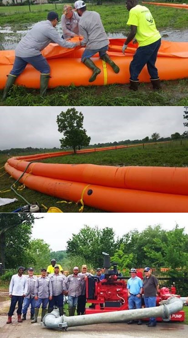
Photo from left to right:
Lloyd Zeno, LMS; Thomas Perrin, FBD; Mark Guerrero, FBD; Keith Mitchell, LMS; Bradley Rubesh, FBD; DJ Kucera, FBD; Glenn Meyer, FBD; Trent Zwahr, FBD; Ron Dechert, Costello; Barry Waites, FB140. (Not pictured: Steve Korenek, Ronnie Mcwhorter, and Steven Svatek, FBD; David Smith, FB140.)